Shotlines are used in seismic surveys to define deep, hidden geological features.
Once a tenement is identified as prospective a bulldozer, loader or other machine is used to clear vegetation from a straight line ‘track’ commonly called a shotline.
Controlled explosions or vibreosis trucks are used at designated points along the shotline to generate shock waves (seismic waves) through the ground and instruments (seismic sensors) measure the reflected/rebounding waves that get disrupted by major geological faults, boundaries and other anomalies.
-
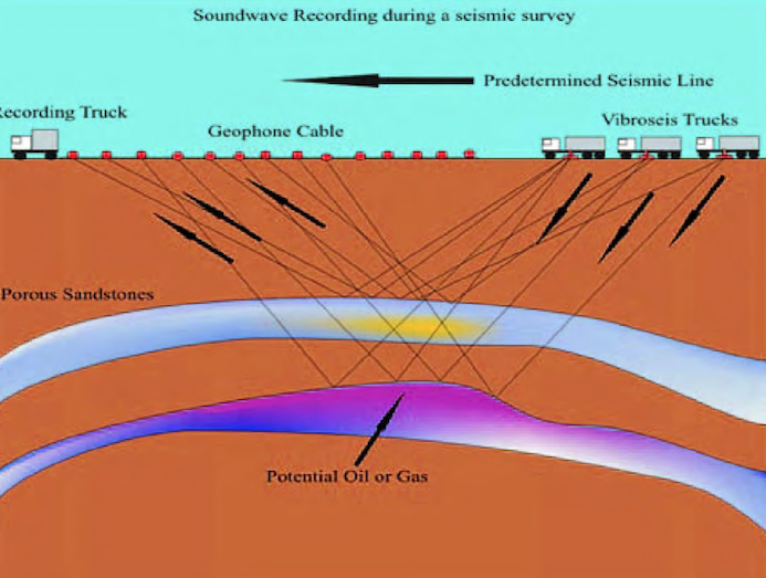
- The ‘Predetermined Seismic Line’ referred in this image is what is known as a ‘shotline’.
This helps to build up a ‘picture’ of what’s happening with the rocks at depth – particularly useful for mineral or oil/gas exploration.