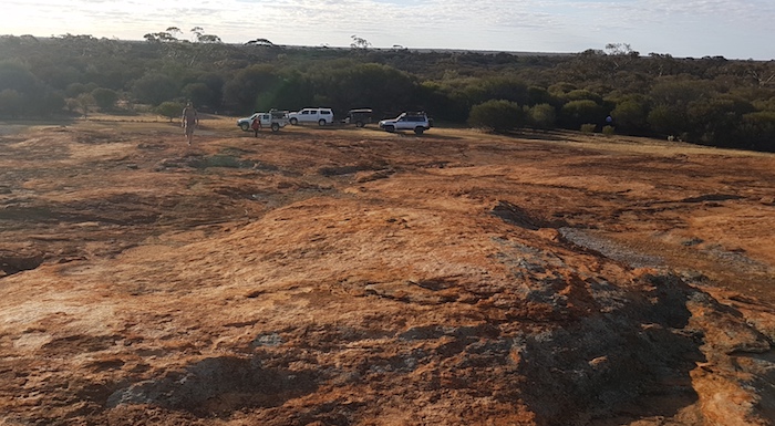
Our route north of Coolgardie took us to Kunanalling, a gold mining ghost town that drew its last breath in 1942.
Kunanalling
Gold was discovered here by Speakman, Erickson and Ryan in 1892 and by 1898 the town was booming. It boasted a telegraph station, police station, court house, government school, post office, mechanics institute, blacksmith, butcher, bakery, grocer and three hotels. Its population peaked at 488 in 1899 and gradually fell away to 105 residents in 1911, then 88 in 1933. before being abandoned during the war years.
-
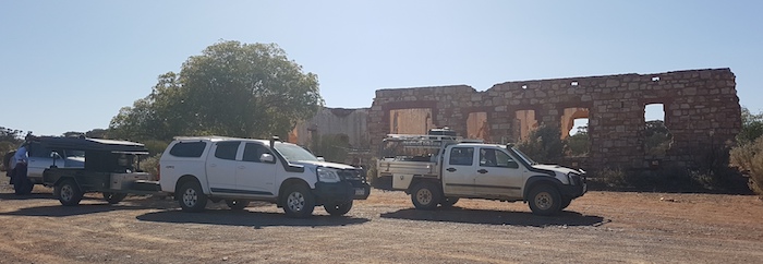
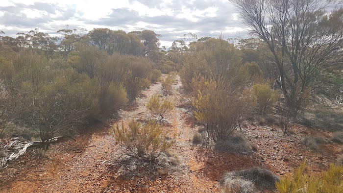
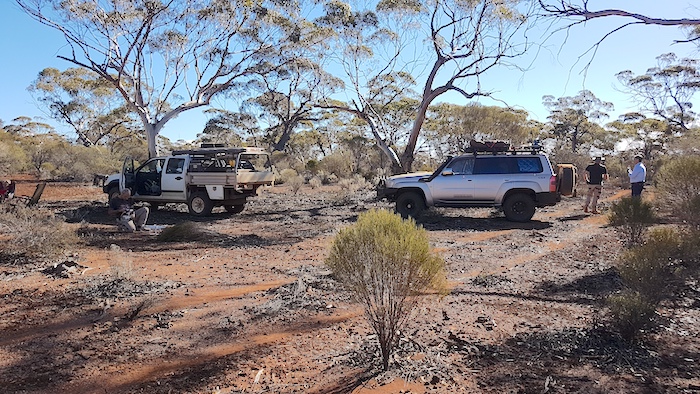
- Aaron’s Patrol, Greg and Margot’s Colorado and Kim’s Rodeo outside Kunanalling ruins.
As was often the case with towns that sprang up as the result of a gold find the first name applied was in reference to the distance from Coolgardie or Kalgoorlie, hence Kunanalling was for many years known as the ’25 Mile’. Research by the Eastern Goldfield Historical Society into the aboriginal name Kunanalling that was eventually used for the town indicates that it means ‘emu droppings’. Probably dressed up a bit.
-
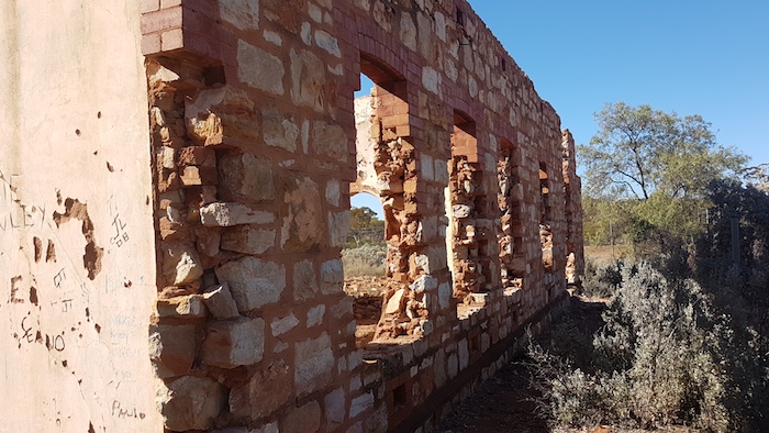
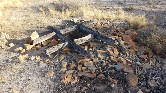
- Kunanalling ruins.
-
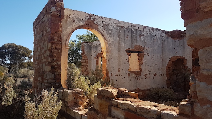
- Once the roof goes destruction is assured.
After taking photographs we continued our trek north-west.
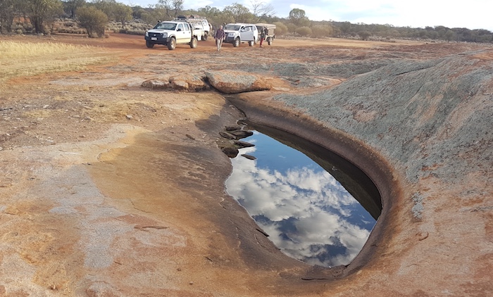
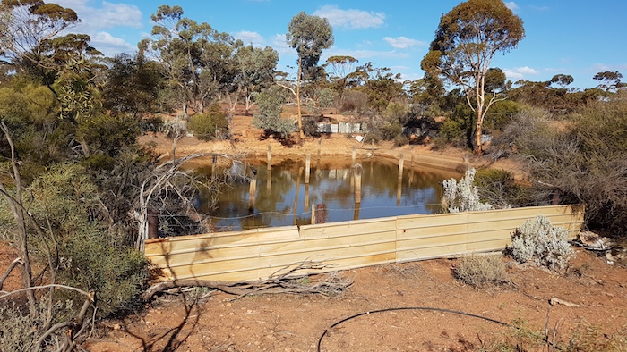
Rowles Lagoon
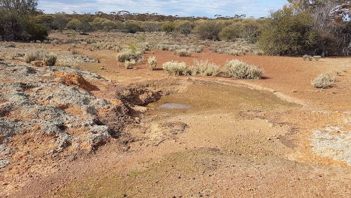
40 kilometres north of Kunanalling is the remarkable Rowles Lagoon, a true oasis in a desert. Rowles Lagoon is the only freshwater wetland in the Goldfields reserved for nature conservation. Along with Clear, Muddy and Carnage Lakes that form the whole wetland, Rowles Lagoon can change dramatically over the seasons and the years. In times of drought they dry out but can flood in years of heavy rains.
-
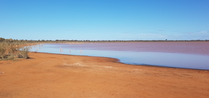
- Rowles Lagoon
Typical of so many DPaW campgrounds, treated pine poles restrict where one can camp – often the location with the best views – and, of course, the area is picked clean of firewood. These ‘attractions’ are best visited without the overnight stop. Instead, find a pristine bush camp with plenty of firewood, a good aspect and convivial company.
-
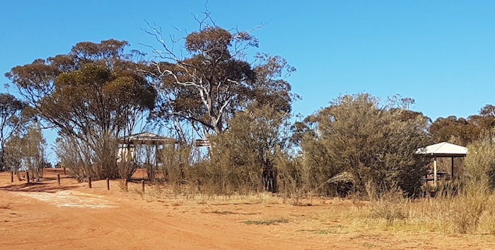
- Facilities at Rowles Lagoon.
Finally ticked Rowles Lagoon off the list of places to visit.
Gus Luck Track
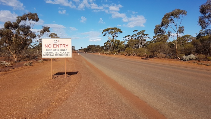
On the way to Ularring we passed the practicable end (or start) of the Gus Luck Track. This Track extends from Weowanie through Darrine, Walangie Soak, 71 Mile Rock, Urdandanging Gnamma, Turturdine Rock, and Coonmine Well to Coolgardie North Road. Luck started his track further north-east at the gold mining centre of Goongarie in 1894, however, following it from/to this point is problematic. Similarly, the portion of the Track from Southern Cross to Weowanie is impossible to follow because of modern day constructions and barriers.
-
- End of the Gus Luck Track.
Gus Luck was a consummate bushman of French origin who taught and mentored one of Australia’s greatest (though controversial) explorers, David Carnegie in the 1890s. Find out more about these two bushmen explorers here and here.
Ularring
There is mineral exploration activity at Ularring but very little else.
This dot on the map is the site of a infamous attack by local aborigines on Ernest Giles’ exploration party in 1875. It has been suggested that the attack came about as a result of the unexpected and alarming amount of water that Giles’ camels were consuming from the soak. Whatever the reason, it was a determined, concerted, and organised attack on an interloping party that was ultimately determined by superior technology. Giles was usually a very flowery writer, however, his description of the attack was very matter of fact.
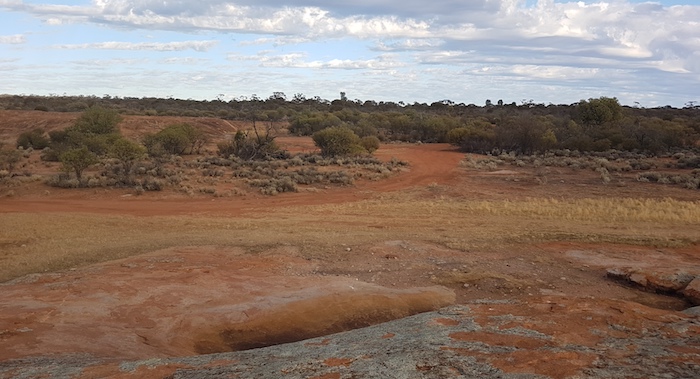
The track from Ularring leads to Bungalbin via a number of rockholes. Planned speed was an average 25 kph, however, we were able to maintain a speed above 40 kph.
-
- Bush in flower along the track.
21 kilometres along the track we passed a track coming in from the Evanston Menzies Road to the north. Nine kilometres further on is Yowie Rockan where another track comes in from the Evanston Menzies Road.
-
- Good views from Yowie Rock.
Six kilometres further on we hit a very rocky section of track.
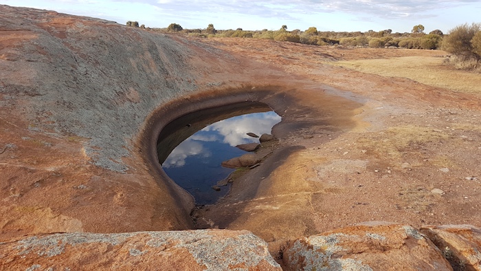
Curara Rockhole and Well
There are numerous gnammas at Curara, 43 kilometres west-south-west from Ularring.
An Army Field Party located this rockhole and named it Cararah Rockhole in September 1963. It was also spelled as Karara Rockhole. Later investigation showed that the officially accepted spelling of the native tree after which it was named was ‘Curara’ and it was amended (along with about 13 other features incorrectly named Karara across the state). Curara is an acacia tree valued as fodder for stock.
-
- Curara Well
The well at Currara Rockhole is in good condition. The placement of logs to protect and mark the well is distinctive.
-

- In good condition.
-

- Distinctive arrangement of logs at Curara.
We camped 15 kilometres past Curara Rockhole on the edge of McArthur Minerals’ active mining tenement.
-
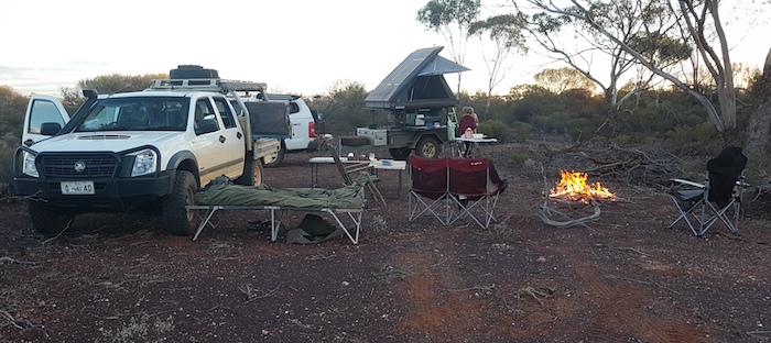
- Our camp near Curara Rockhole.
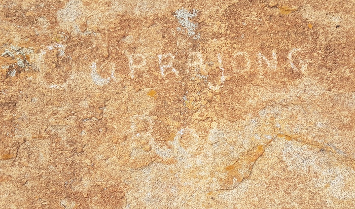
Kurrajong Rockhole
Our drive south-west brought us to Kurrajong Rockhole.
Surveyor A. Henderson led a Field Party in this area in 1966 and named this rockhole during that trip, presumably after the Desert Kurrajong (Brachychiton gregorii ) prevalent in the area.
-
- Kurrajong Rockhole
-
- Once the word is pecked into the rock amendment is difficult.
-

- Vandalism or a petroglyph? Dimer was a well known bush character of the era.
-

- B. Dimer etched his name into the rock in 1960.
-
- Kurrajong Rockhole
-
- A track to the north from Kurrajong.
-
- Gnammas on Kurrajong Rockhole.
-
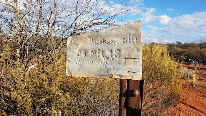
- Bungalbin 23 miles. The direction the sign was pointing could have referred to either of two tracks.
Getting away from Kurrajong proved difficult because of the numerous tracks that lead away from the rock. After a couple of false starts we found the correct track and again headed towards Bungalbin.
Pittosporum Rockhole
The Rockhole is closely surrounded by Pittosporum, a small tree with weeping habit and yellow flowers, hence the name. Ken Newbey requested the name for the rockhole in 1964. More information.
After a chat with some fellow travellers (opposite direction) we drove on.
-
- Four kilometres south-west of Pittosporum Rockhole.
Despite not making the planned overnight camp at Kurrajong Rockhole last night we were ahead of our schedule to rendezvous with Paul at the end of a track off Evanston Road later today. The track from Ularring was better and ‘faster’ than planned.
We arrived at Bungalbin around 10.00 a.m.
Bungalbin
The Mount Manning – Helena and Aurora Ranges Conservation Park is in the Great Western Woodland. Parts of the Conservation Park are under threat from mining and the area has been the subject of controversy for many years. Bungalbin is central to this.
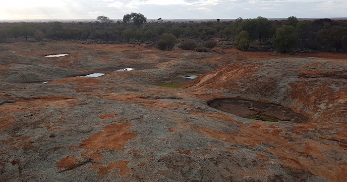
The climb up Bungalbin on the Ridge Track is easy in dry weather but could require low range if wet. While a competent driver could get a camper trailer to the small cleared area at the top it is not worth the risk, given there are suitable areas to unhitch below. The track to the south is not suitable for camper trailers.
-
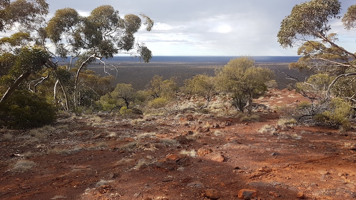
- View from the top of Bungalbin.
-
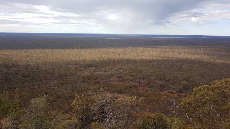
- Looking east.
Rendezvous
From Bungalbin the track leads north-west to Mount Jackson.
At 13 kilometres I located a track to the north that I hoped would take us to Jimbine Rockhole, a rarely visited natural water collection point. The track was barely discernible for about 100 metres and then petered out. I drove cross country, uphill for about 250 metres without being able to locate the track. I had said to Aaron and Greg that we needed to return to the main track and just as I turned to join them I noticed the bare outline of a track heading north.
We followed this for 2.5 kilometres until it took us to a watercourse that we followed east for about 1600 metres. I then picked up a track heading north that I knew would take us close to Jimbine Rockhole. The track improved as we went north.
-
- From barely-able-to-be-seen wheelmarks to an easy to follow track.
Jimbine Rockhole is a small, natural dam in a gully. In 1864 settler explorers Clarkson, Harper and Lukin found this native water supply during an exploring expedition north-east of Toodyay. There were numerous artifacts surrounding the rockhole, confirmation of its importance to aborigines in days past and also indicative of virtually non-existent visitation since Clarkson, Harper and Lukin.
-

- The rock ‘dam’ is natural.
-

- The rockhole has filled in over time.
We returned on our inward track and, with a short deviation, came out onto the Bulgalbin-Mt Jackson track.
There is a certain incongruity in coming out of a twisting, turning, narrow bush track onto a wide, sealed, modern haul road. Crossing it and then going back into the twisting, turning, small bush track makes you wonder if what you saw was real.
-
- Mineral Resources’ haul road.
The track turns to the south-west at Marda and leads to a station dam and cattle yards.
-
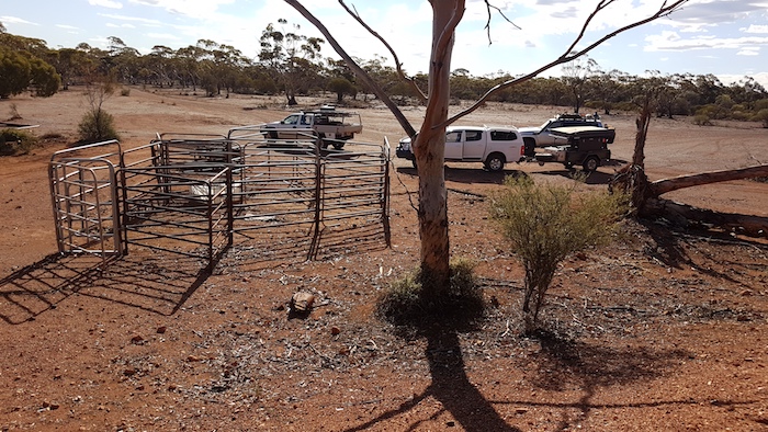
- Cattle yards at Marda.
-
- Marda dam.
Arriving at the Bullfinch Evanston Road we turned left, travelled 14 kilometres south-west and again turned left – this time onto a rarely used bush track. We had planned to meet with Paul late afternoon, seven kilometres in along this track.
During the afternoon we continued along the barely discernible track past where were intended to camp to determine if the track went to Yinyoungning Rockhole. On return to the campsite we had some unusual vehicle damage.
-
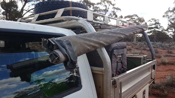
- The bracket that holds the awning to the roof rack broke.
-
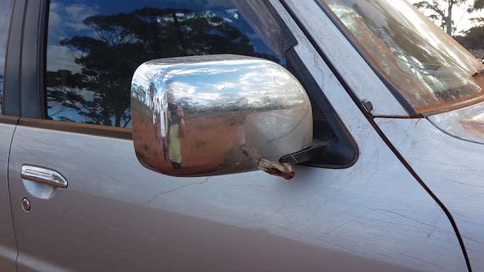
- This stake speared into the mirror frame.
Paul arrived around 4.00 p.m. without Greg who had other engagements.
-
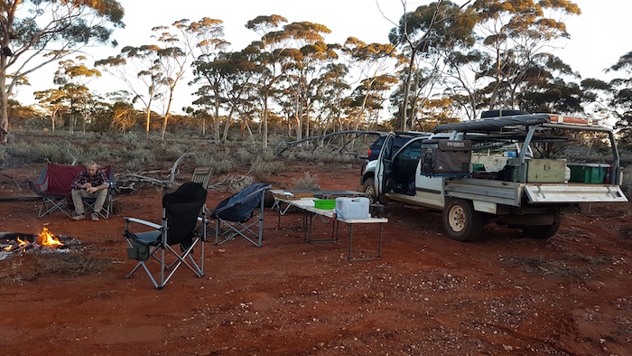
- Greg at our ‘rendezvous camp’.
Prospecting
This part of the trip was designed as a ‘recce’ for an upcoming Gold Prospecting Trip. Aaron and Paul drove further along the track to some prospective ground and spent the morning with detectors having a good walk around the bush. Kim and Greg and Margot ‘rediscovered’ Yinyoungning Rockhole and then joined Aaron and Paul.
-
- Greg sorts out his drone while Paul and Aaron discuss their next gold strike.
In the afternoon we moved to another patch of prospective ground 11 kilometres to the west for another good walk around the bush while diligently sweeping the ground for the elusive yellow metal.
-

- Kim’s Rodeo and Paul’s Navara at our ‘Fault Line Camp’ 11 kilometres south of Mt Jackson.
-

- Greg setting up at our ‘Fault Line Camp.
Mount Jackson Station
On Sunday morning before departing for Cockburn we had a look around at the derelict Mount Jackson Station Homestead.
-
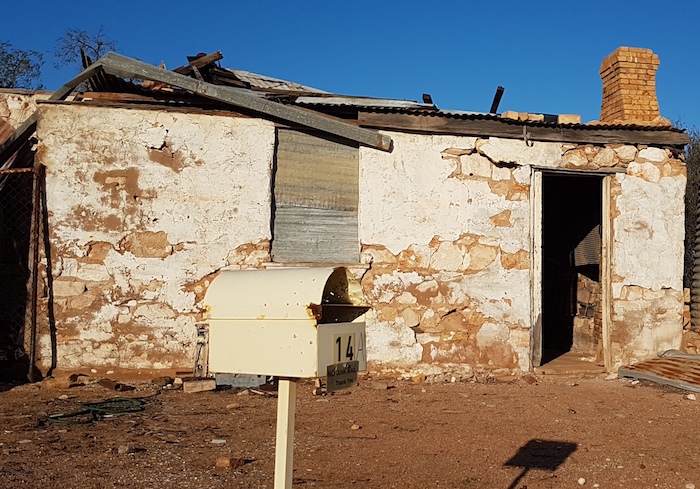
- The Mount Jackson letterbox.
-
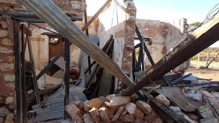
- The homestead is in ruins.
-
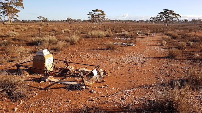
- Cemetery at Mount Jackson Station.
The journey home took us to Elachbutting Rock, Mukinbudin, Dowerin and Goomalling.
© Cockburn 4WD Club 2020
Feel free to use any part of this document but please do the right thing and give attribution. It will enhance the SEO of your website/blog and this website.
1750 words, 40 photographs.
See Terms of Use