
Shoemaker Crater to Glen-Ayle Station
-

- ROUTE FROM SHOEMAKER CRATER TO THE CENTRE OF WESTERN AUSTRALIA
With the marking of the Crater’s centre completed and duly recorded we headed north to a track that we hoped would take us to Granite Peak Station. A dry creek bed presented a delay in getting the camper trailer through, however, that was the only obstacle before we stopped for lunch at a spectacular, unnamed breakaway near the western boundary of Granite Peak Station.
-

- A number of options were considered to get the camper trailer through the creek bed. Eventually, it was reasonably easy.
-

- There was a dozen or so dead camels around the breakaway. All had died of lead poisoning.
Lunchtime Breakaway
The Lunchtime Breakaway is really quite spectacular and deserving of an official name.


Station tracks to Granite Peak Homestead presented another navigation challenge, however, the alternatives we chose were successful and we found our way to near the homestead. As is often the case at station homesteads there are tracks going everywhere and finding the right one is difficult. Granite Peak is no different, however, as ‘all roads lead to Rome’, we duly arrived at the homestead and met the owner, Jim Quadrio. After a quick chat and thanks for access to the station we moved on towards Glen-Ayle Station. We were a long way behind schedule.
-
- Jim Quadrio, owner of Granite Peak Station.
-

- Suzuki Sierras are popular on stations all over WA.
On our arrival at Glen-Ayle there was no-one home. Doors open, lots of vehicles, dogs, horses, poultry but no humans.
Donna made friends with a filly. Still no humans.
-

- Donna with filly.
Steve needed to set up a ‘base station’ so he could achieve an accuracy at the Centre of WA of 20-25mm rather than 1-2 metres that could be achieved by using GPS satellites alone. To do this he would need to place a radio at a known, surveyed point that would transmit continuously to him at the Centre of WA. The only known, surveyed point within cooee of our objective was Standard Survey Mark HP 24, 22 kilometres south-east along the Glen-Ayle Carnegie Road from where we currently were at the unoccupied Glen-Ayle Homestead. Graham jumped in with Steve and accompanied by James and Tim they headed off to find the survey mark and set up the base station.
-
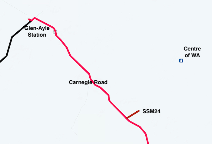
- LOCATION OF STANDARD SURVEY MARK 24 THAT WAS USED AS A BASE STATION.
The rest of the crew found a good campsite a few kilometres from the homestead. Scott and Kim went back to the station about 6.00 p.m. Still no one home.
The wind continued to howl. It normally calms down after the sun dips below the horizon, however, that didn’t happen. After Steve arrived at the camp he voiced his concerns that the strong winds might blow over the base station during the night.
It was a lazy wind, a very lazy wind.
Some time after darkness fell an animal was heard whining/crying off in the distance. Scotty investigated and brought a dog back to camp. It was obviously a station dog. Why was it out here? It was in a bad way. Scotty and others fed it and set up a comfortable bed for it near the fire and out of the wind.

Glen-Ayle Station to the Geographic Centre of Western Australia
In the morning we returned to the station. There was still no human activity. We reunited the hapless dog with its mates. It perked up immediately.
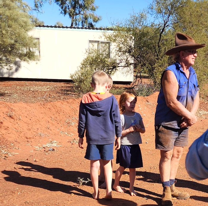
The yapping dogs caused Colin to appear.
-

- Glen-Ayle Station Homestead
The Story of Little Dog
After brief introductions we advised him that we had found his station dog and that it was ok. Clearly relieved, he told us the story of Little Dog. It had been missing for four days and the entire Station workforce had been out on motorbikes searching for it. However, the backstory was even more interesting.
-

- Little Dog – a very fortunate canine.
In 2008 an adventurous woman was travelling south on the Canning Stock Route with camels. She called in to an aboriginal community and came across a dog that she believed was being mistreated so she offered to take it with her – which offer was accepted. When she arrived at Glen-Ayle with her camels and the dog she made the decision to leave the dog at the Station. It was named Little Dog and, coupled with this current event, it is clearly a canine with two fortunate life stories.
Track In
Scotty led the way to the Centre of WA, following wheel tracks of some adventurous visitors who had made their way to the supposed Centre of WA only a few weeks previously. So sad that they didn’t see the real Centre of WA. In a number of places we travelled cross country, along creek lines and through mudholes. Considering that we were in the Little Sandy Desert, there was a fair bit of water laying around. The drive took about an hour.


All vehicles were parked on a clearing at the side of the hill where the supposed Centre of WA is located. A walk track led to the top of the hill on which a small rock cairn had been constructed. Very convenient, very scenic and very much done for the punters. And very wrong.
-

- The track finiishes at a convenient carpark.
-

- A small cairn on the hill adjacent to the ‘carpark’. It is NOT the Centre of WA.
Steve led the way to the real Centre of WA – more than 200 metres away from the BS location.
Marking the Centre of Western Australia
It was now that the preparation and extra effort last evening by Steve, Graham, James and Tim paid dividend. The base station they installed was sending a continuous signal that enabled Steve’s determination of the Centre to be accurate to within 20-25mm. To achieve this accuracy Steve set the base station over a known point – in this case the closest established Landgate Standard Survey Mark (SSM24). The Base Station receives satellite signals (American GPS and Russian Glonass) and applies a correction, so that the received position matches the SSM position. This correction is then transmitted via a UHF radio repeater to the Rover Unit at the Centre of WA area in real time (Real Time Kinetic). The Rover Unit applies this correction to its received satellite signals. This results in an expected accuracy of ± 25mm in X & Y and ± 30mm in Z.
A Survey Controller (keypad/display screen) communicates with the Rover Unit via Bluetooth to record and set out coordinates.
-

- A hole was dug at the approximate centre.
-

- Rapidset goes off pretty quick.
-

- The precise location of the Centre of Western Australia was then determined using a Rover unit.
-

- Adding information.
-

- Surveyor Steve at the Centre of WA with a Trimble R8 RTK GNSS Rover unit.
-

- Centre of Western Australia
Geoscience Australia determined the Centre of Western Australia, using a conic projection and updated to GDA2020, to be at:
25° 19′ 41″ South, 122° 17′ 54″ East
-25.32806, 122.29833
51J 429383 17198541
The survey mark our group, led by Steve Leipold, cemented into position is within 25mm of this.
For a simple explanation of Grid References, Coordinates, Projections, Datums, Tectonic Plates and GPS go here.
It is interesting to note that the Centre of Western Australia using the Linear Method is about 91 kilometre north, in the vicinity of 24° 30′ South, 122° 16′ East.
LOTS of photographs were taken and then it was time to move on.
Photographs of people at the Centre of Western Australia are here.
Next Exploring the Eastern Goldfields
Back to Shoemaker Crater
© 2022 Kim Epton
Feel free to use any part of this document but please do the right thing and give attribution. It will enhance the SEO of your website/blog and that of the Cockburn 4WD Club.
1306 words.
26 photographs, two images.
Photographs
Micaela Anderson
Kim Epton
James Hay
Tayla Skewes
Louise Leipold
Maria Wilson
See Terms of Use